The words “Air Marking” create visions of a biplane releasing smoke traces across the sky. While a romantic thought, it misses the “mark.”Air Marking is painting done under precise federal regulations to designate airports (ex: names and elevations easily seen up to 10,000 ft), directions to airports, or to provide visible compass headings for aircraft to use on the ground or in the air.
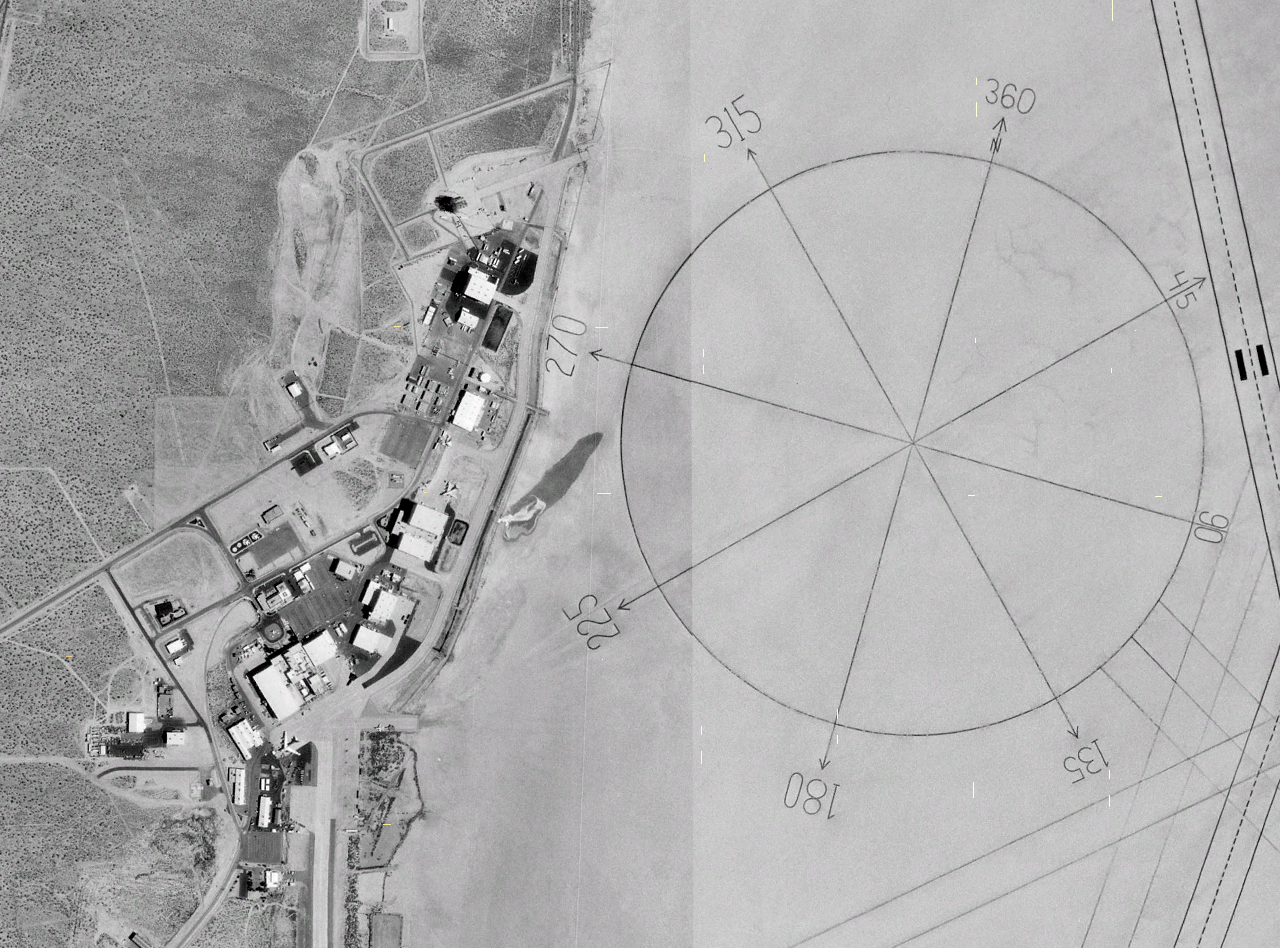
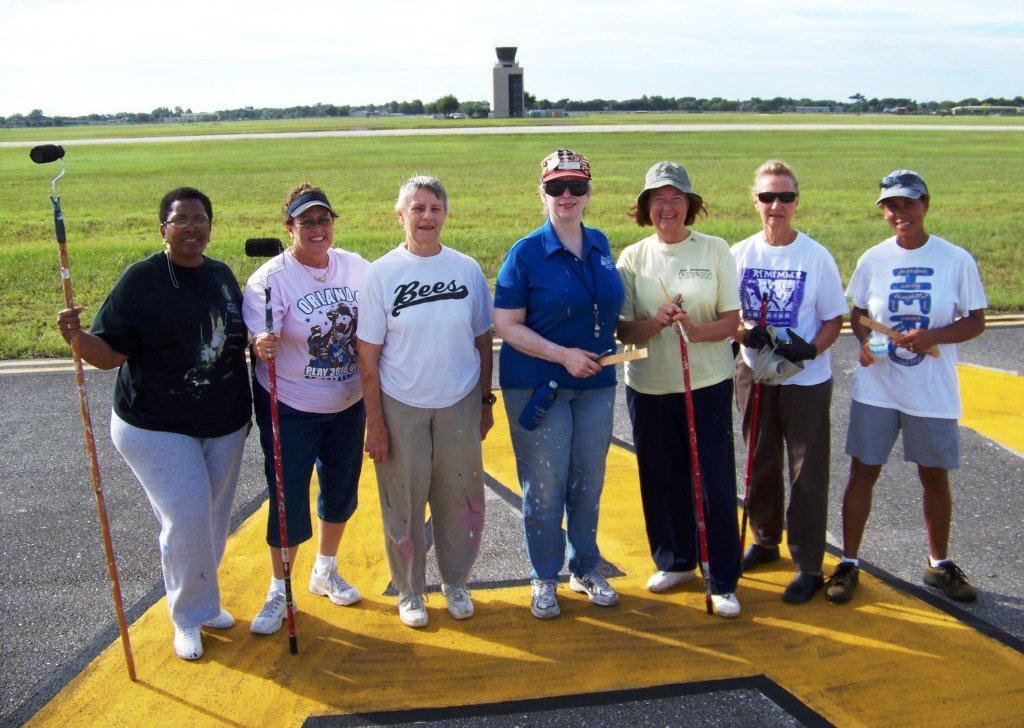
I had a chance to interview Laura Sherwood, an Orlando intellectual property paralegal (trademarks and copyrights), who has been involved with air marking since 1988. As a member of five different pilot organizations, she painted her first compass rose in 1988 at Twenty-nine Palms, California, along with other 99s, an organization of female pilots. Today, she is part of the Spaceport 99s and the air marking organizer for the chapter.
The first air marking started in the 1920s, frequently as signs on barn or business roofs directing pilots to a landing field. Some were as simple as a giant yellow concrete arrow pointing the way. In the late 1920s, beacons, powered by generators housed in small sheds, were placed on top of the arrows (see drawing below). Remnants of the tower frameworks can be found still partially protruding or laying nearby the remaining arrows today.

During World War II, the markings were covered over or destroyed so enemies wouldn’t be able to easily find the airfields. Once the war ended, air marking began again in earnest and it soon became evident standardization was required.

Federal rules for air marking started back in the 1950s. These include things like the size and location of lettering, and the layout for compass roses. Circular FAA advisory circular AC 150/5340-1j covers the regulations.
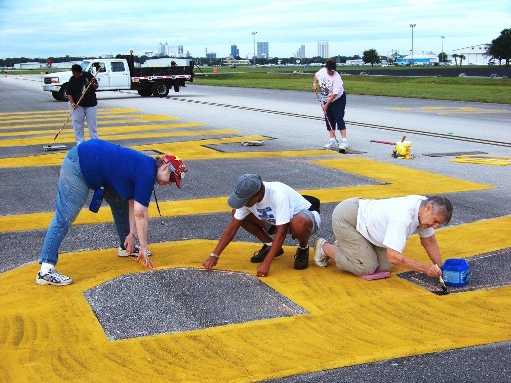
From past experience, Laura said under good conditions, a compass rose can be painted in one day. Lettering takes longer (usually two days) because of the time necessary to block out the lettering.
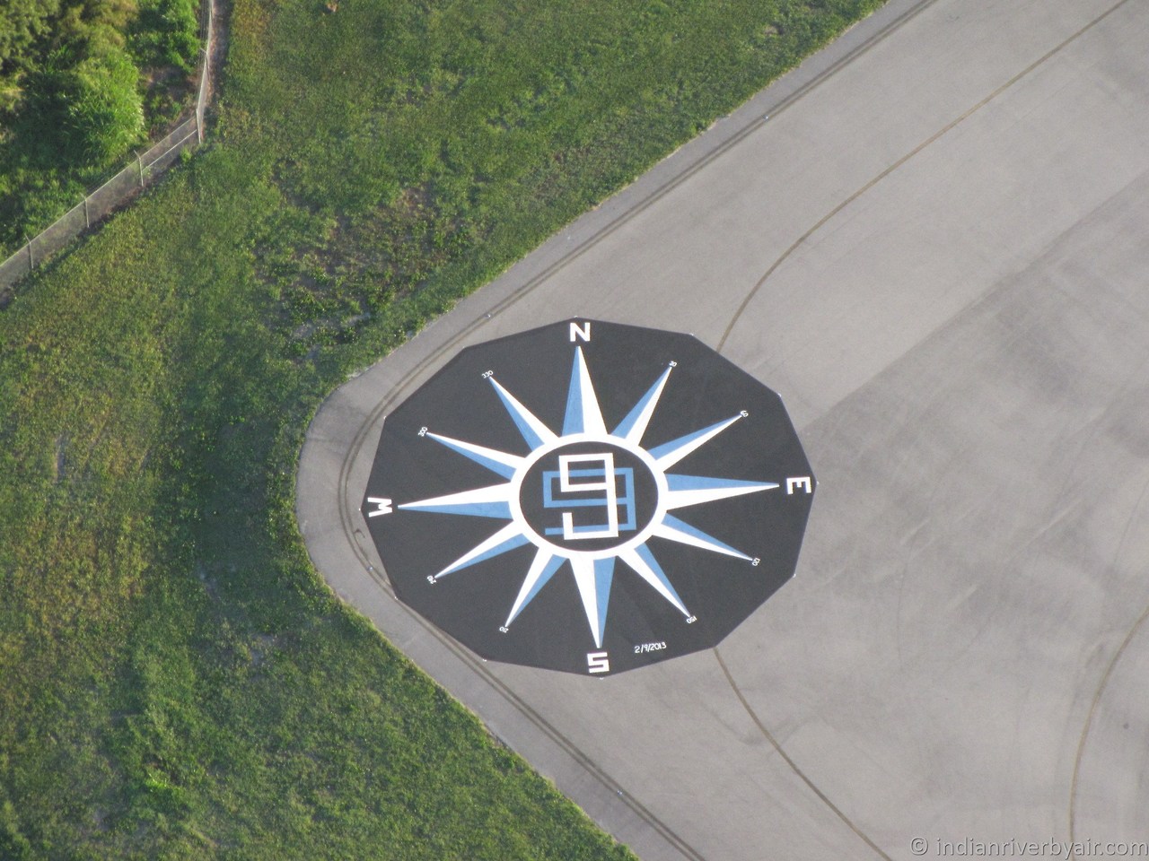
A compass rose size is dependent on the size of aircraft using the airport. The colorful indicators of the four cardinal directions range in diameter from 50 to 100 feet. They must be placed on the airport where planes can access them and swing around to check their compass alignment. Placement must also be away from any source of compass deflection such as electrified fences, strong metal (such as metal buildings), and underground pipes. Concrete buildings do not usually case a problem, but most compass roses are placed about 600 feet from buildings. The airport hires an engineering firm to survey the center mark of the rose and the cardinal points N-S-E-W to meet Federal Aviation Administration (FAA) requirements. On occasion, the surveyors might also mark the 30 degree points, otherwise the painters must be prepared to measure those.
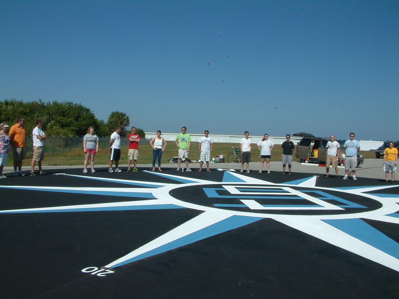
Plan ahead on the time of year for the task. If the tarmac gets too hot, the paint curdles. Too cold, the paint won’t stick. Too windy, it requires a special technique to keep it from splattering in the wrong places. Lastly, having it rain before the paint dries will likely produce a Matisse effect that will have to painted over on a dry day.
So find a friend who knows how to properly lay out a compass rose or airport identifier, grab brushes and more friends willing to wield a brush (a flying organization is a good place to start), bribe with a promise of food, and make short work of the task.
Thanks, Laura for the info and great tips.
I’d love to hear reader comments. Have you ever seen remnants of old air markings on rooftops, or recent ones at a local airport? Even run across one of the old concrete arrows or beacons (there’s a beacon in the Smithsonian)? If so, let me know.
Clear skies and good painting!
***
More references and details on Air Marking can be found at the following links:
– Photos and research on concrete arrows and their beacons can be found at the BonnievilleMariner.com blog.
– In the 2006, AIR & SPACE Magazine article about the early history of air marking championed by race pilot Blanche Noyes.
– At Missourinet: The Blog, a post-war photo and blog of an air marking for Jefferson City Municipal Airport and the tale of pilot Phoebe Fairgrave push for air markings to aid navigation.
– 20th Century Aviation Magazine.com has an article about pilot Louise Thaden and details her involvement in air marking.
– Federal Aviation Administration shares some history about beacons.
***


I’m a journalist researching the origin of an airmark in Woodstock, VA:
https://www.google.com/maps/@38.8826376,-78.5043431,80m/data=!3m1!1e3
The bearing and distance matches the Front Royal/Warren County Airport.
I was convinced this must be a refreshed mark based on the CAB 1935 standard, but a previous owner of the building said it was painted “about 20 years ago by the FAA.” This didn’t make sense. I checked plane and satellite images going back to 1945 and it first appeared between 1991 and 1997. Any idea who might have been involved? I’ve checked all local civic organizations and the CAP. I’m still trying to get someone from the local 99’s chapter to call me back. The Shenandoah Valley Chapter is semi-dormant.
Thanks!
Thanks for contacting me, Bruce. I’ll post this to the International 99s loop and Facebook group and see if someone can help. If nothing comes back, I’ll start circulating it through some of our pilot networks. You’d be surprised at their knowledge base. 99s are the ones who usually do airport compass roses, lettering, and numbers. I personally don’t know about rooftops, but that is possible. We’ll see what happens.
Thanks!
Sandy, a correction, the mark WAS there in 1991. So somewhere after either ’64 or ’79. The imagery quality was poor in the 70’s.
Bruce – In the blog I mentioned that during WWII the markings pointing to airfields to assist navigation were wiped out for security reasons. After the war, renewed efforts to replace/repaint the markings started in ernest again. The 99s were an organization who often did this, but I’m sure weren’t the only ones. Hopefully, the local chapter would have records of the places they painted if you can get hold of someone. I would look into the age of the building, and then maybe ask some of the local historical societies to see if they attempted to preserve the markings (thus repaint them again) if the roof on the building was ever replaced. The county might have records when/if a new roof was put on. Keep us posted as this has gone out to a lot of aviation folks who are now interested in your outcome. If I hear anything, I’ll be sure to pass on the info, too.
Sandy, that thought occurred to me. The building was completed in 1940, but is more than the requisite 150 miles from the ocean so any mark SHOULD have been left. Of course it might simply have been lost due to roof maintenance.
I’m trying to find the year that Front Royal-Warren County airport (the target destination) was built. Obviously the mark wouldn’t have existed prior to that date.
I’ve checked with the Virginia Department of Aviation, the state Aviation Historical Society, CAP, and local fraternal societies without luck. The local historical society is a good idea.
I’m still hoping to find Virginia Thompson, the first president of the Shenandoah Valley Chapter.
She was a contemporary of Blanche Noyes. They were honored by Pres. Kennedy at the White House together with other prominent Ninety-Nines. Virginia seems the most likely authority. I’m continuing to attempt to reach anyone from that chapter.
Thanks for the thoughts and encouragement.
Bruce- Also try the EAA (Experimental Aircraft Association). There should be a local chapter closeby. They do a lot of things like Young Eagle days and many volunteer activities related to flying. They might not have painted the marking, but if they are like our local EAA, there are some old souls who are active and they may likely know about the history. Just another source to try. Several of our 99s are also active in the EAA. Try this link to find the VA chapters. I didn’t see one at Front Royal airport, but you’d be surprised at how these men get around. Many may have flown over and seen that mark for years. https://www.eaa.org/en/eaa/eaa-chapters/find-an-eaa-chapter
Sandy, despite a couple of months of research the origin or the Airmarking in Woodstock, VA is still a mystery. My best guess is that it was done by the sporadically active Shenandoah Valley Chapter of the Ninety-Nines. The final article is available for download on the paper’s Facebook page:
https://www.facebook.com/mountaincourier
Thanks for passing the information along. Perhaps one day the answer will be found.